|
Introduction
|
|
The West Lake Cultural Landscape of Hangzhou represents a masterpiece of creativity displaying the concept of “harmony of humankind and nature” in landscape design. The natural setting of the West Lake cradles the West Lake Cultural Landscape. Naturally created, the lake and hills fit in admirably with each other. In terms of geology, it features the ancient lagoon, the folded hills, and natural elements such as the ecological environment, the unique vegetation, etc. The landscape began to be built since the 9th century, matured in the 13th century, and reached a climax in the 18th century, and continues to develop right up to the present day. It consists of five elements: the beautiful natural setting, the unique layout featuring “Two Causeways and Three Isles” with “hills on three sides and a city on the fourth, the Ten Poetically Named Scenic Spots of the West Lake featuring sceneries in the four seasons, the ten related important historic and cultural remains of great significance |
 |
|
and the time-honored Longjing Tea Plantation of the West Lake. Renowned for its elegant beauty, the natural setting of the West Lake Landscape has been an important theme of Chinese landscape paintings and traditional poems and literature. During over 1000 years of lake dredging and landscape designing, the ideal of the pursuit that human and nature shall be in harmony has been reflected. In 2011, the West Lake Cultural Landscape of Hangzhou was inscribed on UNESCO’s World Heritage List. |
|
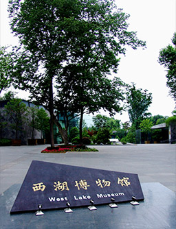
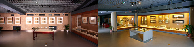
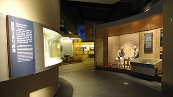
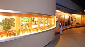
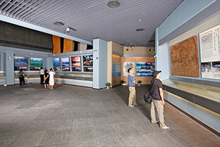
In 2005 the West Lake Museum was established and open to the public. Located at the core of the West Lake scenic area, it is the only lake-themed museum in China dedicated to history, nature and culture of the West Lake, showing all the key attributes of Outstanding Universal Value of the West Lake as a World Cultural Landscape. |
| Natural Formation of the West Lake |
 |
Over the long history, both the geological process that resulted from the internal and external forces and human activities have contributed to the formation of the West Lake. The synclinorium structure of the lake and the rifting force laid the geological foundation for the formation of the West Lake. The climate changes and the fluctuations of the sea level since the Quaternary Period have had direct impacts on the formation and development of the West Lake. |
|
1)The Pre-Paleozoic Era(600 million years ago) Situated in the depression zone on the margin in the south of the Yangtze old landmass. 2)The Paleozoic Era(600 million—250million years ago) On the whole, it was sea enviroment with subsidence as its main movement and also discontinuous swellings to form land. 3)The Mesozoic Era(250—65 million years ago) At the end of the Triassic Period, the violent Indo-China Movement made the stratum form the Sinian to the Paleozoic be extruded and folded. This caused the formation of the cynclinorium structure of West Lake,which was accompanied by a series of rifts to form folded mountains, undergoing weathering and denudation. 4)The Formation and Evolution of West Lake since the Quaternary Period in the Cenozoic Era Broad Valley Phase In the early Pleistocene Epoch, due to long-term weathering and denudation, the area where West Lake was located developed into a broad valley. In the middle and late of the Pleistocene Epoch, there was sedimentary deposit of gravel stones with pluvial-alluvial facies at the broad valley. Old Lake Phase In the early Holocene Epoch, the climate turned warm. Water collected in the low-lying lands and freshwater lakes formed. In the Hemudu Transgression about over 10,000-7,000 years ago, the elevated sea level led to the shallow sea in vast areas east of Hangzhou. Besides, Hangzhou and West Lake were both affected by the seawater. Old Bay Phase In the middle of the Holocene Epoch, the Huangtianban Transgression, which happened about 6,550-5,950 years ago, led to the highest sea level and West Lake became an old shallow bay. At that time, the seawater not only reached the foot of the Lingyin Hill, but also covered a vast area including the Xixi wetland, flooding the entire plain in the north of Zhejiang. Baoshi Hill and Wu Hill became two capes of the bay. Bay-Lagoon Transitional Phase In the late Holocence Epoch about 4,400-2,500 years ago, the third transgression occurred, which is named Zhongjiayi Transgression.At that time, West Lake was still an old bay. Later, the sea level fell. From the period before the Qin Dynasty to the Western Han Dynasty, most part of Hangzhou-Jiaxing-Huzhou plain became land in succession, while Hangzhou was still submerged underwater, without the emergence of West Lake. With the passage of time, the sludge carried by the tide of the Qiantang River silted up in large quantities outside the old bay of West Lake, forming the “sandbar around rocks”, and the sea bay thus became a lagoon. Lagoon Phase About 2,000 years ago, due to further fall of the sea level, Hangzhou became a dry land and West Lake developed into an actual lagoon. Freshwater-Swamp Phase After the formation of West Lake.many streams from the surrounding mountain areas carried freshwater and silt into it.On the one hand,this continuously desalinated the lake into a freshwater lake.On the other hand,the continual deposit of silt reduced the lake to a swamp. West Lake in Modern Times Efforts were made mainly against the possibility of its becoming a swamp.Since the Tang Dynasty,several times of dredging and harnessing of West Lake have been carried out,which has preserved the lake and helped it to develop into such picturesque scenery as we see today. |
| West Lake Fossils |
|
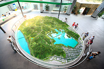
West Lake fossils are the best witness to the vicissitudes of the West Lake landscape. In the late Paleozoic period, local crustal subsidence led to deposition of terrigenous clastic rocks of the late Devonian in the region, where were buried the fossils of West Lake leaves and lepidodendrales unique to a humid climate. At the end of the Early Carboniferous seawater began to intrude the region, an evidence of which are the marine fossils such as those of brachiopods. In the mid Carboniferous period, the sea of Hangzhou was already connected with South China Sea, forming a vast body of shallow-water sea. This period had been extended as far as to the early Permian, a result of which is that sedimentary carbonate rocks in Huanglong Formation, Chuanshan Formation and Qixia Formation are rich in fossils of marine lives, including corals, mosses, crinoids, algae and ammonites. In the late Permian period, the sea water receded from the region, which gradually turned into a land area. And later in the Mesozoic period, the region experienced several intense volcanic eruptions. During the Quaternary period, as a result of several transgressions, the sediment in ancient Hangzhou Bay recorded the marine biological activities with fossils of foraminifera and oysters. Mountains and Hills around the West Lake The mountains and hills around the West Lake stretch from east to west surrounding the lake in a horseshoe shape. On the south, west and north sides, they overlap at a height of 35m to 400m, forming a beautiful scene of “mountains beyond mountains”. This mountainous scenery develops and meanders with rolling ranges at distinct levels and along with the reflection of the lake it forms a long beautiful unfolding scroll-like landscape. The hills around West Lake are relatively small, have varied elevations and can be seen from a low angle of less than 10°, thus ensuring an elegant and beautiful landscape for people to feel close to. Water Area of the West Lake In remote antiquity about 5,950 to 6,550 years ago, the site of modern Hangzhou was only an expanse of sea and the West Lake no more than a shallow bay near the Qiantang River mouth. About two thousand years ago there was only a sandbar built up by the silt carried downstream by the river. It collected between two fingers of land that jutted into the estuary. Later, the sediment gradually blocked the mouth of the bay to form a lagoon and became a fresh water lake with water from creeks and streams of the surrounding mountains. During over 1000 years of lake dredging and landscape designing ever since, the West Lake Landscape has become an outstanding example of continuous human interaction with the natural environment under the impact of various historical changes. The present day West Lake is an oval-shaped shallow-water lake with a north-south length of 3.3 km, an east-west width of 2.8 km, a circumference of 15 km, and a surface area of 5.6 km2. The lake bottom is fairly level with an average water depth of about 2.5 m with the deepest part reaching 2.8 m. The lake is divided by Solitary Hill, Su Causeway, and Bai Causeway into several parts such as the Main Lake, the North Inner Lake, the West Inner Lake, Yuehu Lake and the Little South Lake. Fish and Water Quality of the West Lake According to statistics, there are more than 50 kinds of fish in the waters of the West Lake, which mainly feed on algae and other plankton, thus effectively curbing excessive growth of plankton and eutrophication of water bodies. They play an important role in water purification and in keeping the lake transparent. |
| A Poetic Habitat(The Fairyland Nurturing Great Talents) |
 |
Located in the subtropical zone with four distinct seasons, the West Lake has enjoyed ample rainfall since ancient times. According to archaeological discovery, about 4000 - 5000 years ago, mankind started to inhabit the surrounding area. Throughout historical periods, mankind’s effective protection of the lake further improved the living environment, and ultimately the interdependence between the city and the lake was formed, where man and nature have coexisted harmoniously ever since. |
|
The West Lake is an outstanding example of how man made use of an ancient lagoon and turned it into a livable environment with beautiful landscape. Therefore, the history of the city and the lake is that of the continuous positive interaction between man and nature. |
| Ecological Environment of the West Lake |
| Ecological Restoration of West Lake Water |
|
The reason why the West Lake has survived its long history is closely related to the protection of its water sources in different historical periods. Four streams, namely Jinshajian, Longhongjian, Chishanxi and Changqiaoxi, provide the sources of surface water for the lake. The West Lake protection project has taken a number of measures to control water pollution sources and clean up the upper reaches of its streams in order to improve the water quality of the lake and protect the ecological environment of West Lake and its basin. |
| Hangzhou Changqiaoxi Stream Water Ecological Restoration Project |
|
In carrying out the West Lake protection project, great importance has been attached to the use of advanced technology. A typical example is Hangzhou Changqiaoxi Stream Water Ecological Restoration Project completed in 2006. Since the terrain of the upper reaches of Changqiaoxi Stream is complex, where residential areas are also concentrated, the project has combined the underground sewage purification system with the artificial wetland system for ecological restoration and purification of its water, thus having made it possible for the quality of the West Lake water source to meet the national surface water Class III standard. On the surface a wetland landscape has been created for sightseeing, leisure, and scientific education. The project has won such awards as the National Key Environmental Protection Practical Technology Demonstration Project, China Habitat Environment Example Prize and UN-Habitat Scroll of Honor Award given by United Nations Human Settlements Program. The West Lake is located on the fringe of China’s southeast hills and the northern edge of the sub-tropical zone with an average annual solar radiation of 100-110 kcal/cm2 and 1700-1800 hours of sunshine. The average annual temperature is 16.5℃, and the frost-free period is 245 days a year. It enjoys a subtropical, monsoon climate and four distinct seasons with an annual precipitation of around 1450 mm. The warm and moist climate of the West Lake adds a comely, soft and harmonious atmosphere to the dynamic beauty of the lake, thus creating a rich and diverse ecological environment for the plants and wild animals in the region. The forest vegetation of the West Lake region is mainly the mixed forest of evergreen broadleaf trees and deciduous broadleaf trees. There are over 1000 kinds of animals in the scenic area and throughout different dynasties the lake area has witnessed continuous protection and conservation of its ecological environment, which features a rich and diverse ecological landscape of the West Lake. Distinctive Flora of the West Lake There are a great number of old and valuable trees around the West Lake, among which 126 trees are over 300 years old, including over 20 kinds such as camphor trees, maple trees, Castanopsis sclerophyllas and gingkoes. The oldest gingko in Wutai Hill is more than 1400 years old. In the process of over 1000 years of West Lake Landscape designing, designers allocated distinctive plants in different scenic spots in accordance with their aesthetic characteristics, cultural meanings and spiritual pursuits. These distinctive plants, together with natural hills and waters and man-made landscape, constitute the representative features of West Lake Landscape. From the Song dynasty, the distinctive vegetation around the West Lake have included themed ‘flowers of the four seasons’ with peach blossoms in spring, lotus in summer, sweet osmanthus flowers in autumn and plum flowers in winter; intercropping peach trees and willows along West Lake causeways; and the traditional Longjing tea plantations scattered on the hills to the west of the lake. |
 |
|
The History of Dredging of the West Lake and the Formation of Its Landscape The formation of West Lake Cultural Landscapes should not be taken for granted. Had it not been dredged and harnessed throughout the past dynasties, the lake, as a natural lagoon, would have long fallen into oblivion. A thousand years of continuous dredging has caused a close relation to be formed between the lake and Hangzhou, a famous city in southeast China whose prosperity has been dependent on the lake. What’s more, while dredging the lake, our ancestors, with their wisdom and peerless creativity, integrated poetic ideas and philosophical concepts into the management of the layout of lake, thus embodying Chinese philosophical thinking of the harmony between humankind and nature. From the Qin Dynasty to the Sui Dynasty (3rdCentury BC—7thCentury AD) In the period from the pre-Qin to the Western Han Dynasty (2600 years ago), a lagoon was formed and as water from mountain streams poured into the lake it gradually became a freshwater lake. In the 25th year (222 BC) of Qin Shi Huang’s reign, Qiantang County was established nearby the present day West Lake and this marked the establishment of Hangzhou as a city. In the period of the Eastern Han (25—220), the local official Hua Xin built a dam to defend against tidal bores, thus thoroughly separating the river and lake. There were three natural islands: Solitary Hill, Dingjia Hill and Xizhao Hill in West Lake. With the economic development and population growth in the Hangzhou area, Qiantang prefecture was established in the 1st year (587) of Chen Zhenming’s reign in the Southern Dynasty. |
 |
|
Tang Dynasty (7th- 9thCenturies) During the Dezong period (779-805) in the Tang Dynasty, Li Mi, the governor of Hangzhou excavated six wells to divert water from West Lake for irrigation and to provide drinking water for the urban residents in Hangzhou, creating an inseparable relation between West Lake and Hangzhou, which has lasted until the present day. In 822, Bai Juyi while governor of Hangzhou took charge of dredging West Lake and built a long causeway with the silt from the lake to hold back and store up the lake water. This also aided farmland irrigation and helped beautify the landscape of West Lake, and is a very significant event in the history of the design and development of West Lake’s landscape. To commemorate Bai Juyi, people named the Baisha Causeway, between Solitary Hill and the Broken Bridge, Baigong Causeway. Bai Juyi wrote a great number of poems related to West Lake and because of his marvelous writings, West Lake’s reputation spread far and wide and was especially favored by literati and scholar-officials. During the 7th Century in the Tang Dynasty, Qiantang County moved to the shores nearby West Lake. Since then, the layout of “hills on three sides and the city on the fourth” was primarily formed. During 9th-10th centuries in the Tang Dynasty, the landscape of West Lake began to take shape. The temples and garden landscapes in the areas of Lingyin, Tianzhu, Solitary Hill and Phoenix Hill had become scenic spots known far and wide. Site of Seawall of Wuyue Kingdom: This is the earliest evidence of seawall ever found in China to date. King Qian Liu, through building of seawalls, ensured great expansion of the city wall, thus laying a foundation for the layout of Hangzhou as a city. Late Tang and Five Dynasties (10th Century) |
|
During the Qian period (907-978), the Wuyue Kingdom established its capital in Hangzhou. Qian Liu, the first king (852-932) defended his territory, pacified the people and developed production. He believed that “without water people could not survive”, so he set up a lake-dredging team consisting of one thousand people, which became the earliest professional personnel responsible for dredging West Lake. |
 |
|
Hangzhou became a prosperous place due to diligent governance by five successive kings of the Wuyue Kingdom. Meanwhile, the cultural landscape of West Lake also witnessed further development. During Qian Liu’s reign, Hangzhou was enlarged three times, connecting the western city wall of Hangzhou to the eastern bank of West Lake. This city-and-lake layout remained intact in the following dynasties. The kings of the Wuyue Kingdom piously believed in Buddhism, and enthusiastically built temples, pagodas and grottoes, giving West Lake the most important place in the development of Chinese Buddhism in the 10th century. It was renowned as the “Buddhist Kingdom in Southeast China”. Northern Song Dynasty (10 th -12th Centuries) During the Northern Song Dynasty, all the governors of Hangzhou organized dredging projects, which pushed forward the development of West Lake Landscape. In 1090, Su Shi, governor of Hangzhou, had West Lake dredged at an unprecedented scale and used the excavated silt to build a long causeway. Six bridges were built on the causeway where peach and willow trees were planted. To commemorate his merits later generations called it Su Causeway. In addition, Su Shi built three stone pagodas in the deepest part of the lake and banned the planting of lotus in the area so as to keep the lake surface clean and prevent the lake bottom from silting. The three stone pagodas became a core element of the scenic spot “Three Pools Mirroring the Moon”, one of the Top Ten Poetically-Named Scenic Places of West Lake. As an eminent writer, Su Shi composed many poems related to West Lake, which echoed Bai Juyi’s works, playing a positive role in promoting the discovery, development and spread of the cultural value of West Lake Landscape. |
 |
Southern Song Dynasty (12th-13th Centuries) In the period of the Southern Song Dynasty, Lin’an (present Hangzhou) was the capital of China. With a booming economy and culture, West Lake Landscape reached new heights. A large number of residences, gardens and Buddhist temples were built around the lake, contributing to the large-scale and rich garden landscape featuring hill and water scenery. |
|
In this period, West Lake was repeatedly dredged and became the most important water source for the millions of urban residents’ livelihood and production. In 1247, the governor of Lin’an Zhao Yuchou dredged West Lake to build a long causeway leading to Lingyin and Tianzhu, which was called Zhaogong Causeway. The Southern Song Dynasty following on from the Wuyue Kingdom continued construction of Hangzhou. The western city wall of Lin’an was adjacent to the lake, with three city gates called Fengyu Gate (today’s Yongjin Gate), Qiantang Gate and Qingbo Gate. So the layout of West Lake with “hills on three sides and the city on the fourth” was formally formed. The Qiantang Gate was initially built in 1148. It was used from the Song to the Qing dynasties. The underground ruins of the gate are a witness to the boundary between city and lake in the formation of West Lake Landscape in the Southern Song Dynasty, and provides direct evidence for the layout of West Lake featuring “hills on three sides and the city on the fourth” in the 12th to 20th centuries. Yuan Dynasty (13th-14th Centuries) In the Yuan Dynasty, the Mongolian rulers believed that the imperial court of the Southern Song Dynasty overindulging in enjoyment of the beautiful scenery of West Lake caused the decline of the country. They regarded West Lake as the cause of this calamity and afterwards it was neglected, becoming seriously silted due to lack of dredging or landscape construction. he nomadic Yuan rulers set up the Dudufu (military government) in Hangzhou and injected new cultural elements into West Lake culture. They carved a group of Tibetan-style Buddhist statues on Feilai Peak (Peak Flying from Afar) in Lingyin Temple, which are considered to be art treasures of stone carvings in south China and the most important event in the development of West Lake Landscape in that period. Ming Dynasty (14th –17th Centuries) The development of the culture in the Ming Dynasty saw a cultural renaissance influenced by the Tang and Song dynasties. West Lake once again drew the attention of writers and painters. The design of its landscape and the interpretation of its cultural significance were gradually restored. In 1506, the governor of Hangzhou, Yang Mengying, took charge of the large scale dredging of West Lake and renovated Su Causeway and Bai Causeway. He followed Su Dongbo’s example and built a long causeway with the silt from the lake named it Yanggong Causeway. In 1552, the Mid-lake Pavilion Isle was made on the site of Santan (Three Pools) of the Song Dynasty. In 1576, Xiqing Pavilion was built on it and the construction of the landscape of islands on West Lake was started. In 1589, Sun Long renovated Shijin Pond (Bai Causeway) and built a wooden bridge on the ruins of Hanbi Bridge of the Song Dynasty, renaming it Jindai Bridge. In the Qing Dynasty, it was changed into a single-arch stone bridge and has been used until today. In 1607, the magistrate of Qiantang County Nie Xintang built the pond for freeing captive animals on the location of today’s Lesser Yingzhou Isle. In 1611, the magistrate of Qiantang County Yang Wanli built an outer causeway to the north of the pond for freeing captive animals, and built a water-based garden on Lesser Yingzhou Isle in the shape of the Chinese character tian “田”。 Qing Dynasty (17th –20th Centuries) In the Qing Dynasty, due to the influence of the repeated southern trips and inscriptions on West Lake made by emperors Kangxi and Qianlong, West Lake and its surrounding temples were fully dredged and renovated, helping it reach new heights. West Lake Landscape greatly influenced not only the development of China’s imperial landscaping art, but also the landscaping art in East Asia. During the Yongzheng period (1723-1735) in the Qing Dynasty, Hangzhou’s imperial inspector Li Wei carried out large-scale dredging of West Lake, playing an important role in protecting the beautiful scenery of West Lake. Li Wei paid attention to the construction of scenic spots while dredging West Lake, as well as revising the Eighteen Views of West Lake and compiling the Annals of West Lake. In 1689, when Emperor Kangxi made a second trip south, the temporary imperial palace was built on Solitary Hill. In 1699, when Emperor Kangxi made a third trip south, he made imperial inscriptions about the Ten Views of West Lake, and had steles cut and pavilions built confirming by imperial order that these were the best scenic spots. During the Qianlong period (1723-1735) in the Qing Dynasty, Emperor Qianlong made six trips south. West Lake was dredged several times and the Emperor Qianlong made inscriptions and poems to form the Twenty-four Views, with West Lake Landscape reaching new heights. In 1809, Ruan Yuan, the imperial inspector of Zhejiang, organized the dredging of West Lake, and with the silt an island was built to the north of the Lesser Yingzhou Isle, so finally the layout of the landscape of “two causeways and three islands” was formed. In 1864,Jiang Yili, the imperial inspector of Zhejiang, founded West Lake Dredging Bureau, an agency in charge of dredging of West Lake. During the period of the late Qing Dynasty and early Republic, the West Lake experienced the course of modernization. A large number of distinctive villas and garden architecture were built, most of which have remained intact to date. (Painting: West Lake in the Republic of China) In 1922, the city wall between the West Lake and the city was torn down, thus integrating the city and lake into one. In 1928, the main work was focused on repairing imperial stele pavilions of the Ten Poetically-named Scenic Places. (Photo: Beishan Street) |
 |
In 1929, an order was issued to ban building tombs 150 meters within the West Lake scenic area, which greatly improved the landscape. In 1938, a Lake Dredging Team was formed, whose job was to dredge and clean the lake. In the 1930s, the water level of the West Lake dropped and the bases of the three stone pagodas of Santan (Three Pools) surfaced. (Photo: Three Pools Mirroring the Moon) |
|
After the Anti-Japanese War broke out, as people’s livelihood was greatly threatened and the society became turbulent, the West Lake was neglected. Forests were severely damaged and over 80% of hills became bare. Soil erosion was also serious and the West Lake was silted up with an average depth of only 0.55 meter and water storage capacity of only 4 million cubic meters. (Photos: Tomb of Su Xiaoxiao, West Lake Before Hongli Villa in the 1930s) After the founding of the People’s Republic of China in 1949, a specific administration for conservation and management of West Lake Landscape was established, regulations concerning heritage conservation were formulated and conservation measures were implemented with guiding principles including respecting authenticity, integrity and minimum intervention. |
| Afforestation of Barren Hills |
|
To speed up the afforestation of barren hills, the majority of urban and township dwellers joined the volunteer team for afforestation. Totally 19.562 million trees were planted from 1950 to 1957. Through the measures of closing the mountains for forest cultivation, manual afforestation and planting varieties of tree seeds bearing colour leaves, the landscape with luxuriant towering trees and colourful leaves appeared in the mountain area of the West Lake. |
| The Great Dredging |
|
From 1952 to 1958, a dredging of the lake that intended to extricate West Lake from a predicament toward being reduced to marshland was carried out, which 7.21 million m3 of sludge was dredged from the lake, being a great dredging that removed the largest amount of sludge in history. The depth of the lake increased to 1.8 m from 0.55 m and the sluice capacity went up to 10.27 million m3 from 4.13 million m3 before the dredging. From 1976 to 1982, a second large-scale dredging was carried out to West Lake, dredging up 188,400 m3 of sludge in total. From 1999-2003, a third dredging project was carried out, after which the transparency of the water body was around 0.70 m and the water storage capacity was increased from 9.34 million m3 to 14.29 million m3. |
| Restoration and Conservation of Scenic Spots and Historical Sites |
|
Since 1949, the scenic spots and historical sites around West Lake have been restored and reconstructed. Most of them were revived. The major ones include the Top Ten Views of West Lake, Su Causeway, Bai Causeway, three islands in the West Lake, Solitary Hill, Jade Emperor Hill, Lingyin Temple, Hupao, Jingci Temple, Pagoda of Six Harmonies, Baochu Pagoda, Yue Fei’s Temple and Liu’s Villa. They have been not only restored to their former looks but also enriched with new connotations. |
| Relocation and Landscape Engineering Project around West Lake |
|
The total land area around West Lake takes up 256.1 hectares. In the 1980s, more than 80 hectares of land had been occupied. The buildings were dilapidated in disorder, which seriously spoil the landscape. The Relocation and Landscape Engineering Project around West Lake since 1983 has markedly improved the landscape around West Lake. |
| Water Inlet and Distribution: |
|
Since September 30, 1986, the capacity of water inlet from Qiantang River has reached the volume ranging between 15 million m3 to 40 million m3 each year. The average transparence of the water body was improved by 8.4 cm. In 1998, “Regulations of Hangzhou Municipality on Protection and Management of West Lake Water Area” was issued. Since September 10, 2003, the annual volume of water inlet has increased to 120 million m3 and the water renewal of the lake can be achieved once a month. The transparence of the treated water inlet from Qiantang River is 1.2 m, which greatly improves the water quality of West Lake. (Morning at Pump House of Water Inlet by West Lake) |
| West Lake Comprehensive Protection Project |
|
At the beginning of the 21st century, a large-scale project was launched aiming at inheriting and carrying forward traditional culture – West Lake Comprehensive Protection Project. With the “Convention Concerning the Protection of the World Cultural and Natural Heritage” as its criteria, the project has greatly improved the environment and restored the landscape, thus perfecting the layout of the West Lake scenic area, enriching its cultural connotations, and upgrading the authenticity and integrity of the overall value of the heritage. The heritage protection and sustainable utilization has been finally achieved. In 2011, Hangzhou West Lake Cultural Landscape was successfully inscribed on UNESCO’s World Heritage List. In the post inscription era, Hangzhou Municipal Government has taken economic, social and ecological benefits into consideration and has taken measures to improve protection laws and regulations, rationalize the protection management system, and set up heritage protection, monitoring and management agencies. The management idea of cultural heritage benefiting the public has been adhered to and a sustainable development mode of an elegant and dynamic cultural landscape coexisting with a thriving city has been carried out. As a World Cultural Landscape, the West Lake is a heritage that will be protected and appropriately developed. |
| Principles of the West Lake Comprehensive Protection Project |
|
Protection comes first, with priority given to the ecosystem. The scenic area shall be classified and protected accordingly; with no architecture or structures unrelated to the scenic area being built; all architecture or structures affecting the landscape will be eventually demolished. The density of population and architecture will be reduced; the original biological community’s composition around West Lake will be maintained and restored. More attention will be paid to the protection of water zoology. Through dredging and water-diversion projects and the construction of the Long Bridge Stream Ecological Park, the water in the lake shall be changed once a month, with water transparency reaching 1.2 meters. Inherit history and highlight culture. Emphasis is laid upon the authenticity, integrity and continuity in preserving historical and cultural heritage, while at the same time further tapping up and revealing the cultural significance, and enriching exact cultural details of the national park so as to enhance the perfect combination of nature and mankind. People-first and return the lake to the people. It is important to stick to the conception of people-first and serving the people. The project plan was published in advance, which fully reflects a democratic philosophy in policy-making. By providing visitors with a large number of public service facilities and free admission to parks around the lake, more people are able to enjoy the abundant tourism resources of the lake. So the maximization and optimization of public resources has been achieved.
|

